County Maps
![]()
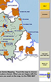
![[County Maps Screenshot]](CountyMapsMainsmall.jpg)
An example screen shot from the County Maps Viewer. |
Large Version |
Click to view online Slideshow
County Maps is the Professional Windows Tool For Historic Map Collections with Easy Public Access.
General Key Features
|
|
|
|
The County Maps system is part of a larger software system for PCs - called the County Record system - which provides a comprehensive Administrative and OPAC system of accessing images and archeological data as well as seamless modern and historic maps. Users of the County Maps system can upgrade to the County Record system as and when required.
The County Record is derived from a project undertaken for Durham County Council Arts, Libraries and Museums Department which was grant aided by the Department of National Heritage under the Public Library Development Incentive Scheme in recognition of its innovative nature.